

Last week, a reorganization of atmospheric processes took place: a long period of sunny anticyclonic weather gave way to cool conditions and rain in Belarus. Thus, starting from the past weekend, the territory of our country came under the influence of cyclonic vortices, whose frontal boundaries brought not only precipitation, wind gusts of up to 22 m/s, and the first thunderstorms of the current season, but also facilitated the influx of cold air from Scandinavia into our region.
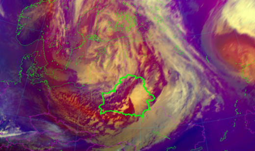
This morning, after allowing another cold atmospheric front to pass, the territory of the republic found itself in the cold and windy rear sector of cyclone Rapunzel, with its center located over southern Finland. Therefore, in most of the territory, in addition to rain mixed with snow pellets, strong gusty winds are observed.
Unsettled weather conditions will persist for the next three days (April 7–9). The cloudy vortex Rapunzel, moving eastward, will merge with cyclone Quiana, forming a single cyclonic depression, and the republic will continue to be located in its rear sector. Consequently, Belarus will continue to experience windy weather with precipitation. During the daytime of April 7 (Tuesday), due to the development of cumulonimbus clouds in the southern regions, thunderstorms are possible. As a result of the advection of air masses from northern latitudes, the temperature background will drop and approach March values. Nighttime lows will range from -4°C to +5°C, while daytime highs will fluctuate from +2°C in the north to +10°C in the southwest.
At the same time, a tight pressure gradient combined with the development of convective processes will contribute to increased wind with gusts of 15–20 m/s. Due to the expected adverse hydrometeorological phenomenon on April 7 (Tuesday), an orange hazard level has been declared for the southwestern half of the republic.
According to preliminary forecasts, on April 10–12 (Friday–Sunday), the influence of frontal boundaries will weaken, and with rising atmospheric pressure, precipitation will become local and short-lived. At the same time, cold weather will persist, with temperatures generally 1–6°C below the climatic norm.
Weak icy conditions will be observed in some areas during the night and morning hours.
When using the information a reference to Belhydromet is obligatory
© Belhydromet, 2016-2026