


Overview of hydrological situation of February 20, 2026
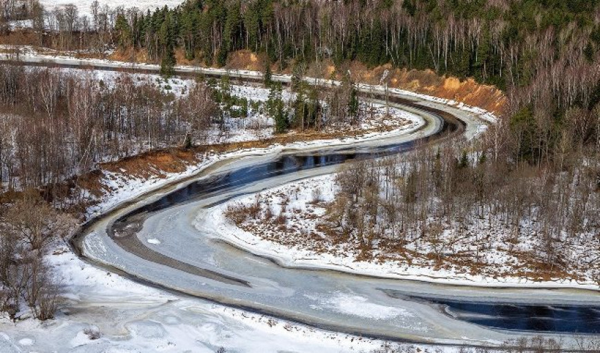
As of February 20, rivers are predominantly experiencing complete ice cover and ice cover with open leads, with ice thickness ranging from 9 to 45 cm.
On the Vileyka, Chigirinskoye, Soligorsk, Zaslavskoye, and Krasnaya Sloboda reservoirs as well as on Lakes Naroch, Drisvyaty, Chervonoye and Lukomskoye a continuous ice cover persists with thicknesses ranging from 33 cm to 46 cm.
On almost all rivers across the country, a recession in water levels and a steady water level regime are observed. Only in the rivers of the Pripyat basin is a rise in water levels mainly recorded; however, its intensity is low, amounting to 1-4 cm per day.
On the Ptich River a tributary of the Pripyat near the village of Pervaya Slobodka the water level exceeds the mark for flooding the floodplain.
.jpg)
When using the information a reference to Belhydromet is obligatory
Specialized sites
Informational resources
 State Symbols of the Republic of Belarus
 The National Legal Internet Portal of the Republic of Belarus
 The Ministry of Natural Resources and Environmental Protection of the Republic of Belarus
 The Official Internet Portal of the President of the Republic of Belarus
 The Portal for Rating Assessment of the Quality of Services Provided by Organizations in the Republic of Belarus
 The CIS Interstate Council for Hydrometeorology (CIS ICH)
 Information Analysis Portal of the Union State
 The Union State Committee on Hydrometeorology and Environmental Contamination Monitoring
 The Internet Portal "The Youth of Belarus"