


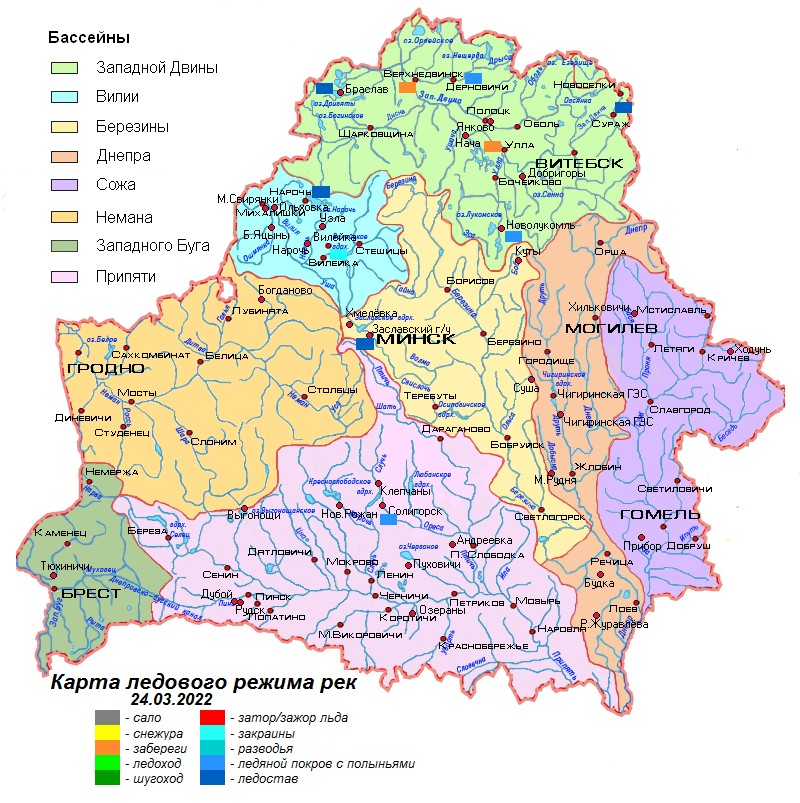
24.03.2022
Overview of hydrological situation of March 24, 2022
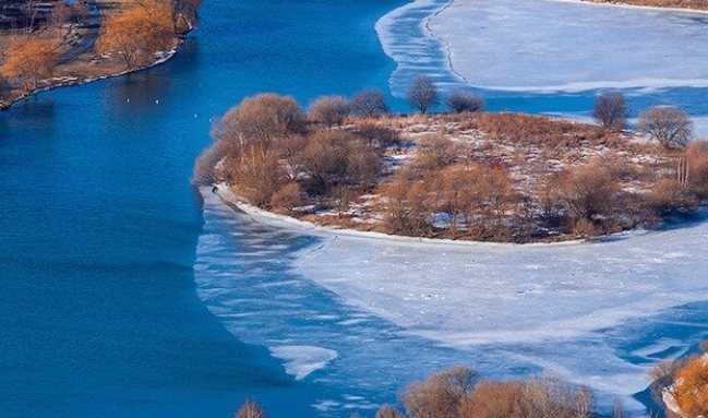
Over the past day, a tributary of the Zapadnaya Dvina, the Obol river, opened in the area of the settlement Obol; the Western Dvina near the city of Polotsk and Lake Chervonoe cleared of the ice formations.
As of March 24, freeze-up and freeze-up with polynyas are preserved on the Zapadnaya Dvina at the site of the source - Surazh, its tributaries, the Polota river and the Drysa. On the reservoirs Vileyskoye, Chigirinskoye, Zaslavskoye, Soligorskoye, lakes Lukomskoye, Drivyaty and Naroch, ice formation, ice formation with polynyas are observed, ice melts in some places, water on ice is noted. Going out on the ice is dangerous! Residual landfast ice is observed on the Zapadnaya Dvina near the settlement Ulla and the city of Verkhnedvinsk.
An increase in water levels with a daily intensity of 1-19 cm is noted on the Zapadnaya Dvina, the Viliya, the Sozh in the Krichev-Slavgorod section, the Dnieper in the Orsha-Mogilev section, some of their tributaries, as well as individual tributaries of the Neman, the Berezina and the Pripyat. On the rest of the Dnieper, the Sozh, as well as on the Neman, the Berezina and the Pripyat, there is a decrease in water levels of 1-18 cm per day.
The water levels exceed the water outlet marks on the floodplain on the Dnieper near the settlement Loev, the Pripyat near the city of Mozyr, its tributaries the Styr river near the village of Lopatino, the Sluch nearthe settlement. Lenin, the Ptich near the village of P. Slobodka.
In the coming days, the destruction of the ice cover will continue on the Zapadnaya Dvina and the water bodies of the country; the Polota River, a tributary of the Zapadnaya Dvina, will open. In some sections of the rivers, the rise in water levels will continue. Water will enter the channel on the Pripyat near the city of Mozyr.
 Official heraldic symbols of the Republic of belarus
 Internet portal of the President of the Republic of Belarus
 National legal Internet portal of the Republic of Belarus
 Ministry of natural resources and environmental protection of the Republic of Belarus